Sunday, November 7, 2010

Grand Canyon - S. Kaibab to Bright Angel Trail

7:30am - 5:10pm

S. Kaibab Trail down to the Colorado to Phantom Ranch, go along the River Trial and come up through Bright Angel Trail
Party: David
Distance is 17.5 miles
Elevation gain is ~4460 ft

Trail head to the Colorado River - 2 hr 30 minutes
Started at Phantom Ranch going up at ~11:50am
Arrived at Indian Garden at ~1:50pm
Started from Indian Garden at ~2:20pm


"Never attempt to hike to the river and back in 1 day." At least that is what every sign you see in Grand Canyon tells you. That is very true in the hot months of the year, and that is what the park service is not telling you. However, in late spring and fall, which is the best possible time to visit the Grand Canyon, hiking to the river and back in 1 day is not as impossible as the Park Service wants you to believe as long as you are in reasonably good shape. Don't get me wrong, people do die here, often too, so one has to be prepared and the weather has to cooperate as well.

I have dream about the impossibles ever since I visited the Grand Canyon in the mid 1990's. Many possibilities considered, from hiking down and taking the Mule ride up, to getting duffel services, to staying overnight at the Phantom ranch - which the reservation is almost impossible to make. Finally, just toughing it, by finishing the hike in 1 day. It turns out to be less dramatic than what it was portrayed to be except for the scenery, which worth every bit of enjoyment.

The weather was projected to be low 20's just 3 days before the hike. That was when David and I finally decided this is the weekend we will go. Bought the flight tickets, booked the rental car on Thursday. Luckily there is still 1 room available at the Maswik lodge at the south rim which where we staged for the hike on Sunday. Got to SFO ~1 hour before the flight on Saturday, my backpack had to go through the scanner 2-3 time only to have the security finding out I have a mini swiss army knife in my hiking first aid kit. It took me no time to decide that they can keep it so I can get through the check point. Got to Phoenix rather uneventful thankfully. Got the rest of our supply such as water and more snake for the hike at the Target over in Phoenix and again at Flagstaff on the way to the Canyon. Not to mention the Starbucks to fuel the minds so the car can stay on the road the whole way.

There is definitely no lack of mis-information coming from the staffs inside the Park. First the wrong information about no bus going to the trail head before 7am - it turns out that the bus started at 5am in the morning. If I would have know, we would start the hike at 6:30 rather than 7:30am. Another staff told us the trail was close the morning of our hike, if that turns out to be true, we would have been extremely devastated. We just realize that there is no lack of confused employees in the park to make sure none of the visitors get all the correct information, include the facts that can help capable hikers to do the same day hike to the river and back (at the right time of the year, of course).


With a view like this, we soon forget about the lack of assistance by the Park staffs.

The weather turns out to be much better than we anticipated. Morning temperature on top of the south rim is up in the high 30's or low 40's, very mild wind at the top, almost non existence. That makes it a very comfortable start. No shivering and hands are free to operate camera and GPS without all stiffed up. As you can see, the view down the Grand Canyon is pure gorgeous. If you keep hearing the magnificent colors of the Grand Canyon, you need to see it early in the morning during sunrise or late in the afternoon during sunset. You are missing out if you only see the Grand Canyon in broad daylight mid afternoon. Everything is too washed out in the midday sun for one to truly appreciate the beauty of the Canyon.

We are standing at the trail head of the South Kaibab trail and finally about to get started down the canyon wall. This is extremely exciting looking down the trail. And in no time, we are inside the canyon looking up. It is a wonderful experience just for being below the rim as this has been a dream of mine for so long.


*** more to come***

Sunday, September 12, 2010

Mission Peak with Elizabeth

Walked up mission peak (almost) all the way to the Sunol overlook. There is where the 5th bench is. From the car, she climbed more than 1700ft in about 2 hours. This is amazing for a someone who just turned 7 less than 1 month ago.

I am extremely amazed and proud of what this little girl is capable of.

Sunday, August 29, 2010

Mount Diablo - Summit Trail

8:04 AM - 11:40AM

Same old route from south gate to summit.
10+ miles and 3200ft of elevation gain.
Details captured in 2008 hike.

The only different this time is I got up to the summit in just a few seconds under 2 hour.
Round trip time is just over 3.5 hour.

A little bit faster that the 2 year younger version of me.
That was ~3 hour to the top and 5 hour round trip...

Tuesday, August 17, 2010

Lessen Volcanic Park - Lessen Peak Trail

8:42am to 11:22am

Lassen Peak Trail Head to Lassen Peak and back
Party: Simon
Distance is ~5 miles
Elevation gain is ~2000 ft
(trail head at 8500ft to peak at 10500ft)
Trail head to Top of Lessen Peak - 1 hr 24 minutes

After the July trip passing through and briefly visited Mt St Helen. I thought it would be interesting to go climb a volcano. Mt St Helen is a bit of a way away and Lessen Peak is relatively a lot more accessible. It turns out to be quite a wonderful hike. The weather is perfect, other than the fact that there was a 30-40 mph wind close to the peak.


Above is a view from a few mile away from the trial head and a "full" view of the trial to the top.

A picture of the valcan eye above is formed by volcano activities pushing a column of rock out from underneath. A reminder of the active earth below. On the right is looking up from the trail head. Below are picture of an interest "building" at the peak, a missile like capsule probably housing an antenna of some sort.


The triangulation marker placed by the USGS. From this point looking north is Mt Shasta. Another California volcano which is part of the Cascades.


A tremendous view of Lake Helen at the base of Lassen Peak.

Tuesday, July 6, 2010

Juneal, Alaska - East Medenhall Glacier Trail

~9:30am to ~1:00pm

East Mandenhall Glacier Trail
Party: Tour group from the same cruise
Distance is ~4.5 miles
Elevation gain is ~500 ft
Latitude - 58.3N (the most northern hike so far)

Hiking in Alaska... Wow! Something I have been looking forward to ever since we book the cruise ticket about 1 month ahead of the trip. What would it be like? It doesn't really matter. It would be "cool" hiking on top of the world (latitude wise).

I wasn't expecting a quick drive-through tour for Juneau... Well, why not, I am on a tour anyway.

Well, there were a lot of unexpected when I finally got on the hike. First of all, I didn't expect it would be drizzling in Juneau. What? They actual rain 300 days out of a year? Okay, many of those days were snowing. That's news to me. Where was my windbreaker? Back in California... I was the only person on the hike with a short sleeves. Com'on! Its Alaska after all, I cold have at least bring some long sleeves... Luckily it wasn't that cold and I warmed up 5 minutes into the hike. I was the East Mendelhall Glacier Trail we were on.

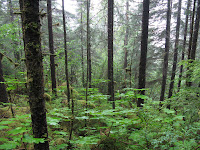
As for the trial... It was not anything I expected at all. Why would I expect to hike in a rain forest in Alaska. Ferns, more ferns and moss I have every seen in my life. How can so many trees grow on the solid granite without even any soil? How would the moss grow on all these trees? It was magical and magnificent... I was walking on roots and moss like hard wood floor and carpet. With the tranquility, I was out of this world.


About an hour into the hike, Mendelhall Glacier comes into sight. It was illusive for the beginning coming in and out of the fog. With some patience, the Glacier shows it grandiose.


It was worth the wait. Far better than taking a bus and going to the visitor center. This is a true complete immersion of myself in the wilderness of Alaska. The full experience.

Now, here is the sad part of the story. I found out later that one of my coworkers went to the same place about 10 years ago. The Glacier was almost 1 mile closer to the visitor center than it is today. The Glacier has receded a lot over the past decade and it is not slowing down. Go before it disappears.


Saturday, June 19, 2010

Yosemite - Four Mile Trail + Panoramic Trail + Mist Trail

6:00 AM to late afternoon

Valley to Glacia Point via 4 mile trail
to top of Nevada Fall via Panaramic trail
to Happy isle via Mist trail
Party: Dave
Distance: ~20 miles
Elevation Gain: ~4000+ ft